


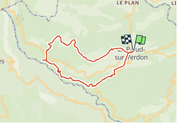


12.1 km | 26 km-effort


User


FREE GPS app for hiking
 SityTrail
IGN / Geographical institutes
SityTrail World
The world is yours!
Trail Walking of 18.7 km to be discovered at Provence-Alpes-Côte d'Azur, Alpes-de-Haute-Provence, La Palud-sur-Verdon. This trail is proposed by ETMU5496.
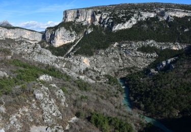
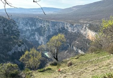
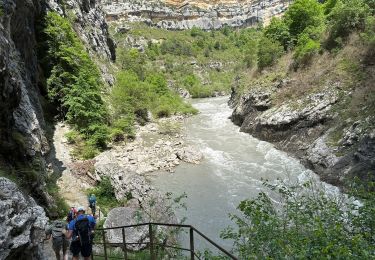
jolie boucle à faire par beau temps mais pas trop chaud.
Le sentier bastidon est exposé au soleil.
Par contre le reste du tracé demeure globalement ombragé


24 photos in total. Please click on a photo to see them all in the gallery.

Walking

Walking

Walking

Walking

Walking
Walking
Walking
Walking
Walking